
The enigmas of mars(24)
페이지 정보
작성자 별사나이쪽지보내기
메일보내기
홈페이지
자기소개
아이디로 검색
전체게시물요원
댓글 0건
조회 1,105회
작성일 10-01-25 10:28
별사나이쪽지보내기
메일보내기
홈페이지
자기소개
아이디로 검색
전체게시물요원
댓글 0건
조회 1,105회
작성일 10-01-25 10:28
본문
MARS GIANT PLANTS & LAKES
Report #020
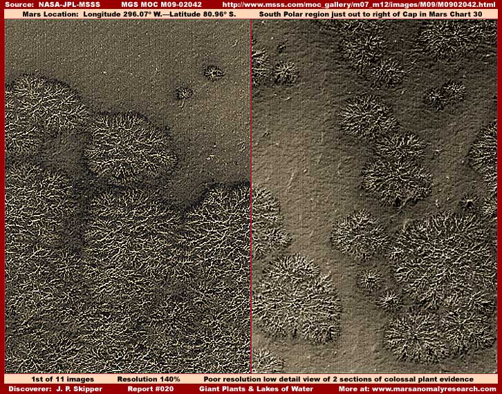
This is a complete overhaul of the previous (year 2001) Report #020 on evidence arising out of the MGS MOC M09-02042 strip. The evidence consists of the giant or colossal size plants you see in the above first image as well as extensive old growth bio-life forests, very obvious water lakes in a liquid state, some suggestive civilization evidence and, unfortunately, image tampering.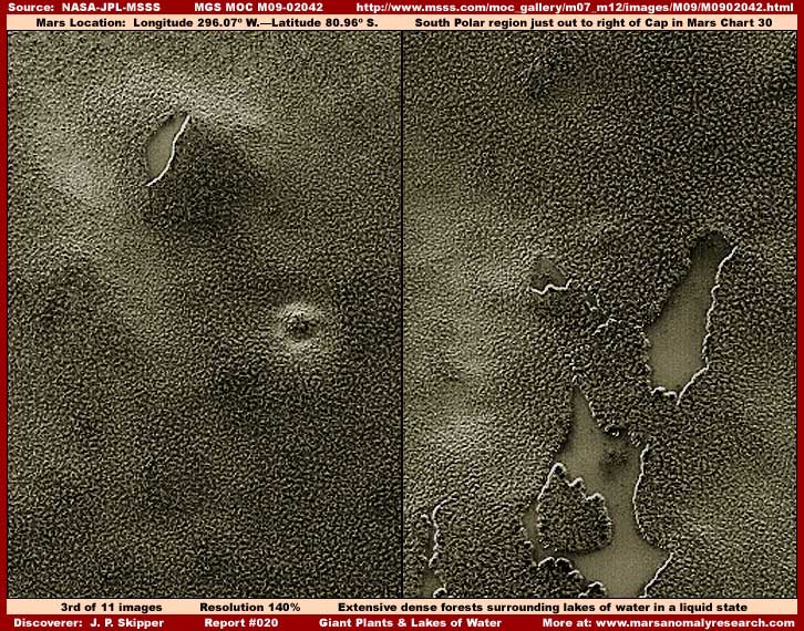
The image evidence is located all the way at the other end of this long narrow M09-02042 strip and, in my opinion,
it is the most obvious and significant in this reporting as evidence goes. Make no mistake about it, you are looking at
very extensive and dense old growth bio-life forests that are surrounding and growing right up to the edge of lakes of water. Please note that very significantly and unmistakably the water in these lakes is in a unfrozen self leveling flat
surface liquid state.
The significance of this combination of bio-life forest and water lakes in a liquid state ON MARS, the planet that is officially supposed to be dry as dust with a 95+% carbon dioxide lethal atmosphere and dead, just can't be understated even though this evidence has so far been ignored by the in denial science and academic leadership conditioned by decades of the secrecy agenda tacticals. Mark my words, when the book evidence of equal caliber comes out in a few months reinforcing evidence like this and unmentionable things start hitting the fan, it will be definitive evidence like this languishing in this record since May, 2001 that the upset critics and those looking for blame will come back to in demanding to know how evidence so incredibly obvious could be so ignored for so long by the science and academic communities even though it is verifiable right in the science data.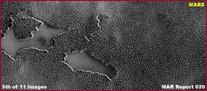
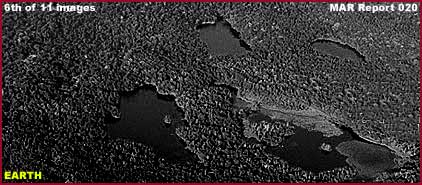
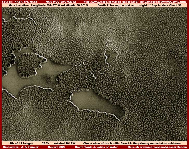
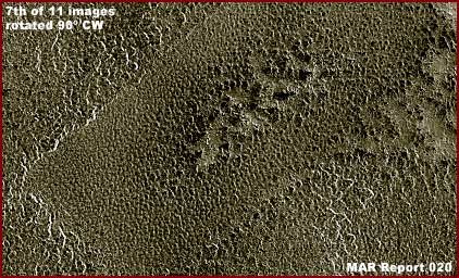
The above fifth and sixth black and white images demonstrate a A–B comparison between the Mars forest and lake evidence and the same type of evidence from Earth. Both represent multiple water lakes surrounded by dense bio-life forests growing right up to the edges of the lakes. The difference is that the Earth lake water is a bit clearer and less occluded than these particular Mars lakes.
Also, the Earth forests are made up of a considerable variety of tree life merging together while the Mars much more uniform appearing forest seems to be made up of the same kind of bio-life species that is also a bit larger from object to object and more evenly spaced apart. This may suggest that the Mars forest is very old growth where one species over a great span of time has come to dominate the available terrain. The Earth image is of Japan's Shiretoko National Park and was brought to my attention by a long time supporter from Australia who prefers to remain anonymous.
The image evidence is in this same strip and so I've included it here. The site is located in the mid area of the strip and the view here is from one side of the strip to the other with the edges of the strip cutting off two opposite end
corners of a relatively shallow depression. It demonstrates the majority part of an old perfectly rectangular shallow
depression in the terrain now grown over by vegetation.
Note the perfect 90º right angles and the two arrow straight long linear side lines. Even though old and now grown
over, there is obviously not much chance of symmetry this perfect being the result of natural nature or geology.
This has the appearance of a artificially engineered and dug flat floor depression except for something bulky and
upright in the exact center of it. The strip resolution is too poor here in this area of the strip for a closer examination
of detail. However, I suspect that the higher elevation elongated material in the center of the depression represents now grown over ruins. Want to bet on it?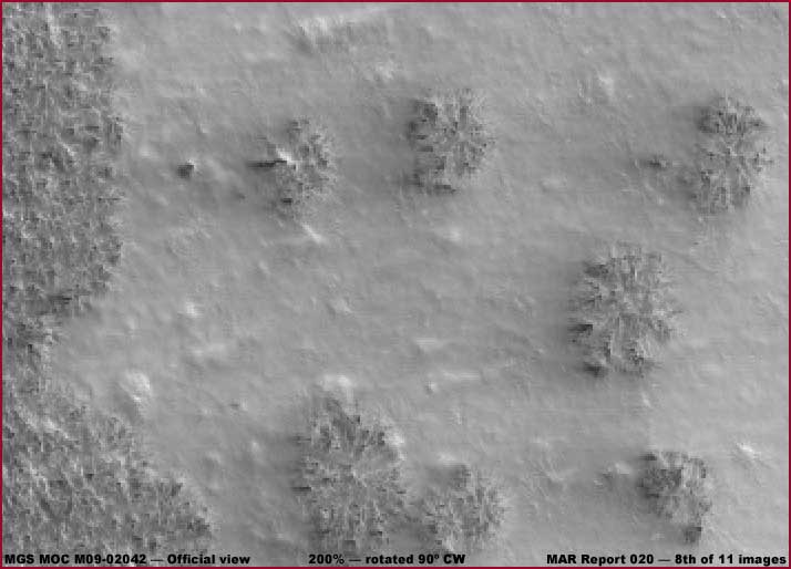
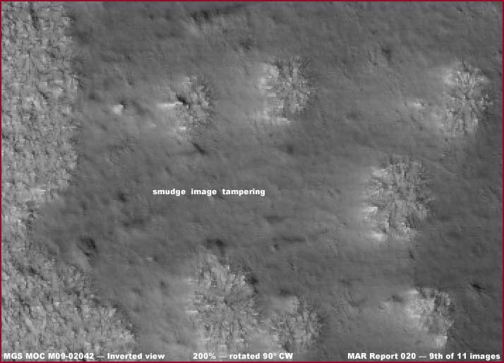
There are a great many forms of image tampering and many are used in combination. For example, in this case the
original strip has been subject to resolution problems and the whole strip has been subjected to the distancing
technique reducing the strip to a very narrow band. However, the easiest and most obvious to identify image
tampering has been disguised by inverting the original image and doing smudge image tampering applications in the
inverted view and then inverting the image back again for release to the science communities and public.
In the real inverted view as represented by the above 9th image, the smudge dithering applications are simply crudely
laid down on top of the already compromised colossal plant evidence and, as you can see, are very obvious.
The process of then inverting the image back to the original view effectively plasters down the smudge so that it
appears to hug the ground it covers as represented by the 8th image. In fact, there is no ground visible at all, only
this plastering down of the smudge applications hiding what ever it is they are hiding and to mimic terrain geology.
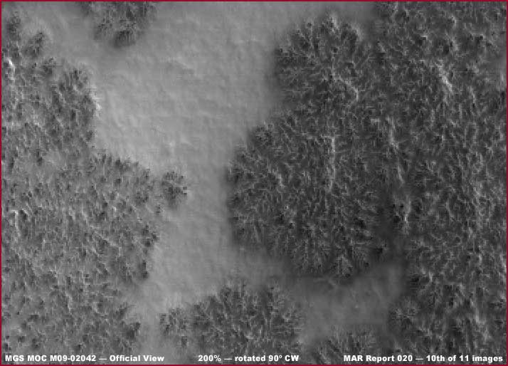
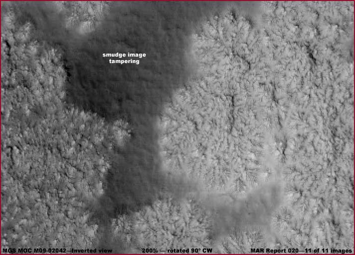
To drive this point home, the above 10th and 11th images are another example of this, just in a different location in
the strip but still among the colossal plant evidence. The 11th image represents the real inverted view with the crude
smudge tampering applications in it and the 10th image represents the inverted back view with the smudge
applications now plastered down again mimicking terrain appearance. It really can't get more obvious than this
but that isn't quite all.
댓글목록
등록된 댓글이 없습니다.
 사라랜스
사라랜스 nabool