The enigmas of mars(31)
페이지 정보
작성자 별사나이쪽지보내기
메일보내기
홈페이지
자기소개
아이디로 검색
전체게시물
댓글 0건
조회 1,358회
작성일 10-02-02 10:14
별사나이쪽지보내기
메일보내기
홈페이지
자기소개
아이디로 검색
전체게시물
댓글 0건
조회 1,358회
작성일 10-02-02 10:14
본문
MARS STRANGE EVIDENCE
Report #131
jskipper@marsanomalyresearch.com" target="_blank" rel="nofollow noreferrer noopener">
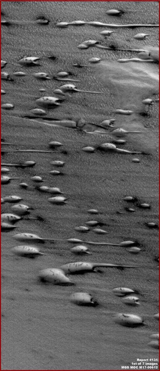
The above first image is from the upper portion of the very long official MGS MOC M17-00612 narrow-angle straight .
GIF strip. The view is the full size as the strip is officially presented and from one side edge to the other which the
image stats say is 1.66 km or 1.03 miles across, although I wouldn't place too much confidence in those stats
if I were you.
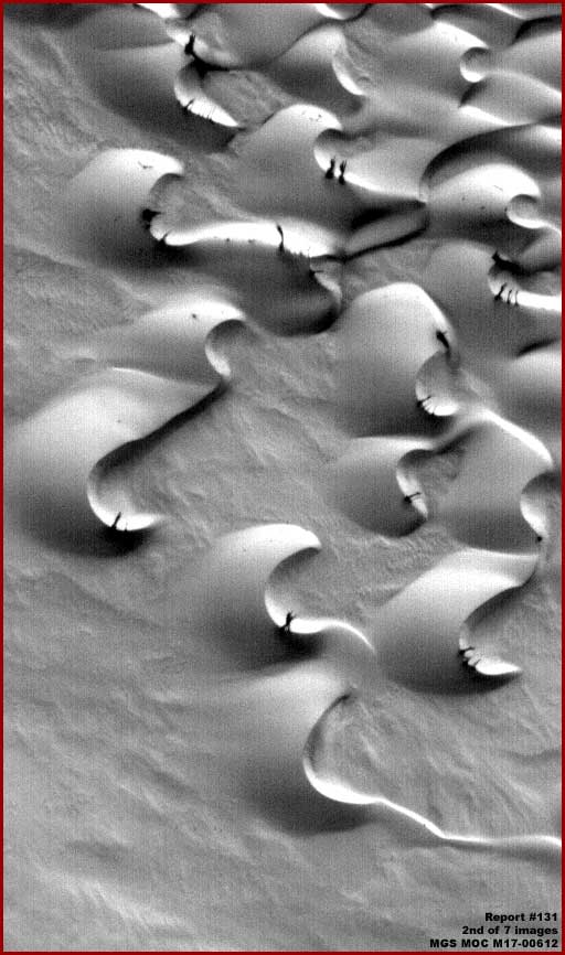
The above second image is from the lower portion of the same very long official MGS MOC M17-00612 narrow-angle
straight .GIF strip. Again the view is the full size as the strip is officially presented and from one side edge to the other.
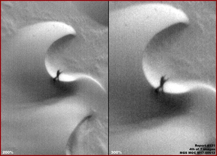
Obviously the dark evidence in the above fourth image looks a little like some bipedal being with two arms raised in
supplication in the direction of the Sun. I have no idea what is going on here but I suspect this is just a chance
configuration of this distinct vertically upright dark material resembling living bipedal anatomy. Also, remember that
normal size objects take a visual beating in this imaging and the above strange looking dark evidence therefore is
actually very large to be seen at all here.
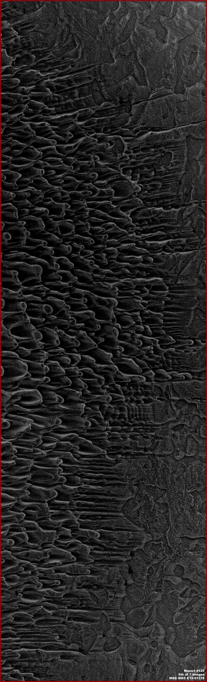
The above fifth image is from the different MGS MOC E15-01378 narrow-angle straight .GIF strip. The view is the full
size as the strip as officially presented and from one side edge to the other, which the image stats say is
3.44 km or 2.14 miles across. Again, anything that we would consider normal size will be obscured in such a poor
resolution image and only huge objects can be seen adequately.
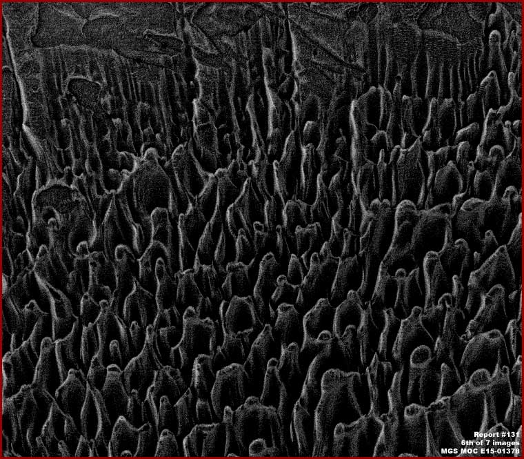
The above sixth image from the same MGS MOC E15-01378 strip demonstrates a portion of the same evidence in
the fifth image at the same resolution but here rotated 90º counter clockwise. As you can see, in this view it begins t
o be more understandable why the software is counting so many upright objects down there. If this is the correct
orientation as suggested by the software and I believe that it is, there are a lot of very large very upright objects
down there and you'll note that they no longer resemble dunes either.
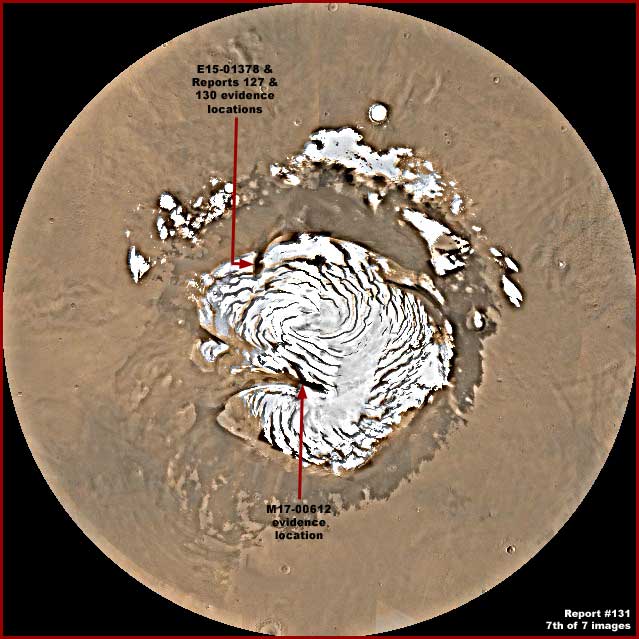
The above last image in this report is a global view of the North Polar Region with the North Polar Cap in the center area. The red arrows point out the location of the two different evidence sites in this reporting.
The bottom site darker area pointed out with the red arrow where the first presented evidence here in this report is
located is within Chasma Boreale which, as you see, is a huge depression that extends deep into the Cap interior and
even distorts the shape of the Cap. Some of the terrain in this Chasma appears to demonstrate evidence of strong
periodic shallow liquid broad flows across some of the Chasma ground surfaces likely ultimately exhausting out the
Chasma opening to the left that also likely contributes to its tapered widening there, build up of sediment there,
as well as the absence of Polar Cap highly light reflective snow/ice there.
댓글목록
등록된 댓글이 없습니다.